

Professional Aerial
Imaging & 3D Modeling Services
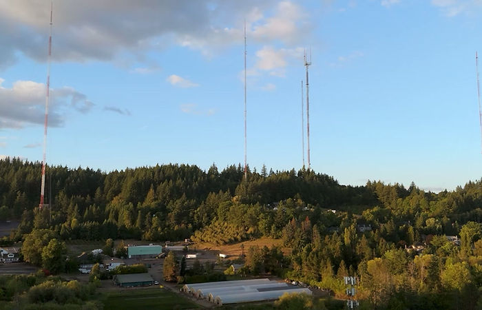
Drone services in Portland, OR - from high-quality aerial photography to 3D modeling to 2D site mapping.
Interested in aerial 3D models? View 3D Models >
Our Services
Professional aerial services for real estate, construction, contractor work, creative projects, and more!

Aerial Photography
High-quality aerial photography tailored for real estate listings, site progress tracking, documentation, or marketing materials.
Aerial Videography
Cinematic 4K aerial videos showcasing projects, properties, and landscapes from dynamic perspectives, delivering engaging visuals, ideal for marketing and presentations.

3D Aerial Models
Practical, lightweight, and accessible 3D aerial models that are perfect for large-scale visualization and easily viewable on any phone, tablet, or computer.

2D Mapping & Orthomosaics
Detailed 2D aerial maps and orthomosaics created with the use of photogrammetry, providing clear overviews of locations for planning, documentation, and project management.
Industries Served
Serving industries that benefit from detailed, high-quality aerial perspectives for marketing, documentation, and project oversight.
-
Construction & Contracting
-
Real Estate
-
Airbnb & Vacation Rentals
-
Property Management
-
Landscaping & Outdoor Design
-
Hospitality & Tourism
-
Agriculture
-
Small Event Production
-
Local & Community Projects
-
Small Business & Commercial Marketing
Our Service Areas
Based in Northwest Portland, we proudly serve the Portland and Vancouver metro areas, providing professional aerial photography, videography, and 3D aerial modeling services for a wide variety of applications in the region.
If you have any questions regarding our service area, please do not hesitate to contact us.
Please note that McMinnville, Yamhill, Woodburn, and Camas may be subject to our extended service area fee.
About Us
Dedicated to providing clear, reliable aerial imagery for projects across Oregon and Washington.
Local roots
Based in Portland, OR, SkySight Aerial Solutions is locally owned and built around an understanding of the region’s landscapes and weather. Being close by allows for flexible scheduling, quick communication, and reliable service tailored to local needs. We bring regional knowledge that helps capture accurate, relevant aerial imagery for any project.
certified & skilled
Every flight is backed by FAA Part 107 training and a strong understanding of airspace rules and safe drone operation. With careful planning and controlled maneuvers, each project is handled with precision. The result is clean, dependable aerial imagery you can trust for practical use and clear decision-making. All of our drone pilots are certified by the Federal Aviation Administration.
Our mission
Our mission is to deliver clear, reliable aerial visuals that help clients understand their properties and projects from a new perspective. We focus on safe operations, honest communication, and results that are genuinely useful, not just visually appealing. SkySight exists to provide straightforward, dependable aerial services.
